Perdeu a senha?
Novo usuário? Criar uma conta
Aprecie e contribua!
| Achar os melhores spots |
|
|
 Peru
Peru
América do Sul
Localização: Western South America, bordering the South Pacific Ocean, between Chile and Ecuador!
Coordenadas geográficas: 10° 0' S, 76° 0' W
Costa: 2,414 km km
Clima: varies from tropical in east to dry desert in west; temperate to frigid in Andes
Relevo: western coastal plain (costa), high and rugged Andes in center (sierra), eastern lowland jungle of Amazon Basin (selva)
Cimeiras:
Riscos naturais: earthquakes, tsunamis, flooding, landslides, mild volcanic activity. deforestation (some the result of illegal logging); overgrazing of the slopes of the costa and sierra leading to soil erosion; desertification; air pollution in Lima; pollution of rivers and coastal waters from municipal and mining wastes
Moeda: nuevo sol (PEN)
População:
Línguas: Spanish (official), Quechua (official), Aymara, and a large number of minor Amazonian languages
Capital:
Divisão administrativa:
Você quer acrescentar outras informações sobre Peru? Diga-nos...
Este mapa é interactivo! Use os controles para fazer zoom ou para se deslocar.
- secções (0)
- viagens (0)
- Fotos (9)
- Vídeos (0)
- Compartilhe
- Favoritos
-
Os seus sítios favoritos e as futuras listas de spots
Spots
| Spots (4) | Qualidade | Experiência | Tipo | Acomodações | ||
|---|---|---|---|---|---|---|
| Lobitos | - / - | Peritos | Praia | 

|
||
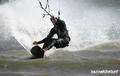
| Mancora | 3 / - | Todos | Praia |


|
||
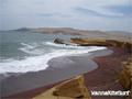
| Paracas | 3 / - | Todos | Estuário |


|
||
| Puerto Morin | 3 / - | Todos | Praia |
|


 Comentários
Erros, Reacções
Se você quer adicionar novas informações ou se você encontrou erros nesta página, Envie as suas observações