Perdeu a senha?
Novo usuário? Criar uma conta
Aprecie e contribua!
| Achar os melhores spots |
|
|
 Uruguay
América do Sul
Localização: Southern South America, bordering the South Atlantic Ocean, between Argentina and Brazil
Coordenadas geográficas: 33° 0' S, 56° 0' W
Costa: 660 km km
Clima: warm temperate; freezing temperatures almost unknown
Relevo: mostly rolling plains and low hills; fertile coastal lowland
Cimeiras: lowest point: Atlantic Ocean 0 m
highest point: Cerro Catedral 514 m
Riscos naturais: seasonally high winds (the pampero is a chilly and occasional violent wind that blows north from the Argentine pampas), droughts, floods; because of the absence of mountains, which act as weather barriers, all locations are particularly vulnerable to rapid changes from weather fronts
Moeda: Uruguayan peso (UYU)
População: 3,477,778 (July 2008 est.)
Línguas: Spanish, Portunol, or Brazilero (Portuguese-Spanish mix on the Brazilian frontier)
Capital: Montevideo
Divisão administrativa: 19 departments: Artigas, Canelones, Cerro Largo, Colonia, Durazno, Flores, Florida, Lavalleja, Maldonado, Montevideo, Paysandu, Rio Negro, Rivera, Rocha, Salto, San Jose, Soriano, Tacuarembo, Treinta y Tres
Você quer acrescentar outras informações sobre Uruguay? Diga-nos...
Este mapa é interactivo! Use os controles para fazer zoom ou para se deslocar.
- secções (0)
- viagens (0)
- Fotos (3)
- Vídeos (0)
- Compartilhe
- Favoritos
-
Os seus sítios favoritos e as futuras listas de spots
Spots
| Spots (3) | Qualidade | Experiência | Tipo | Acomodações | ||
|---|---|---|---|---|---|---|
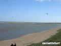
| 31 De La Brava | - / - | Intermediário | Oceano aberto | 


|
||
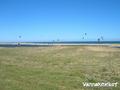
| Laguna Garzon | 2 / - | Todos | Lagoa | |||
| Laguna Jose Ignacio | 1 / - | Todos | Lagoa |

 Comentários
Erros, Reacções
Se você quer adicionar novas informações ou se você encontrou erros nesta página, Envie as suas observações